

Download The Climate Impact Company Week 2-4 Outlook for Europe
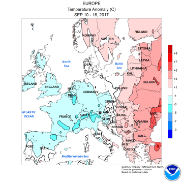

Pictured: Last week’s observed temperature anomalies and precipitation amounts across Europe.
We have an interesting development. Last December a long-term intense drought affecting Western and Central Russia was in-place. Suddenly, evolution of a deep upper trough developed which lasted through the first half of 2017 and caused enough precipitation to weaken, if not reverse drought conditions in this part of Russia. And now the opposite condition has evolved. An intense upper ridge returns to Northwest Russia/North Europe most impressive in the 6-10 day period promoting warmth and dryness beyond meteorological summer. Upstream from this warm ridge Europe is also generally warmer and drier than normal except for an upper level low producing showers in Southeast Europe.
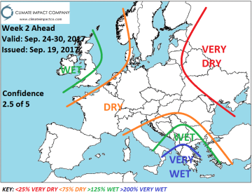
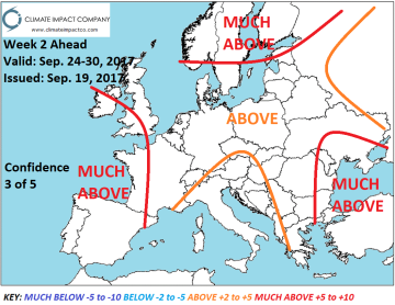
Pictured: Next week’s precipitation and temperature anomaly forecast across Europe.


