

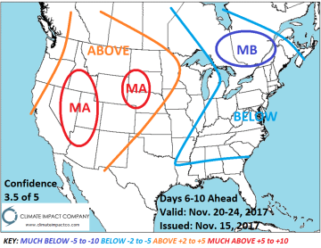

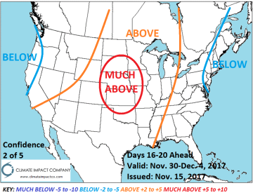
Pictured: The Climate Impact Company medium/extended-range temperature anomaly forecast for the U.S.
Blocking pattern over northeast Canada causes a cold upper trough to anchor over the Northeast U.S. in the 6-10 day period. During the period the Northwest is less wet than this week. In-between the Great Plains are dry during the medium-range. In the 11-15 day period eastern cold fades while the Great Plains are mostly milder and drier than normal. By days 16-20 the warm pattern in the West shifts to the Central U.S. A dry climate is maintained at that time. Snow cover in the North-Central U.S. may retreat the next 2 weeks while deepening in the far Northwest and northern New England States.


