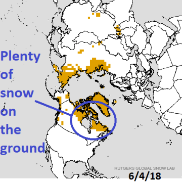
Charts of the day: Cold northern North Atlantic affecting climate and keeping northeast Canada snow-covered. Occasional chill into the Northeast U.S. from this source region.
Discussion: A cold SSTA pattern southwest and south of Greenland is causing the atmosphere to stay colder than normal in this region which in-turn keeps northeast Canada snow-covered providing a cold air mass source region for occasional visits into the Northeast U.S. (Boston had a maximum temperature of 53 yesterday).

Medium-range 6-10 Day Forecast Valid June 10-14, 2018

Medium-range 11-15 Day Forecast Valid June 15-19, 2018
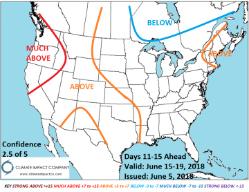
Discussion: Incoming cool air mass into the Northeast U.S. days 6-10 also enhances a wetter pattern in the East which expands and further cools the eastern half of the nation days 11-15.
Extended-range 16-20 Day Forecast Valid June 20-24, 2018
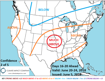
Discussion: Cool weather in eastern Canada surges southwestward to Montana. Ahead of the cool surge the East turns warmer.
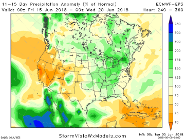
U.S. Medium-range %Normal Rainfall Forecast Using ECM Ensemble
Discussion: The clear trend is wetter Southeast/Mid-Atlantic days 6-10 and westward into the Great Plains days 11-15. Wetter weather suppresses heat risk.